
Farming seaweed using robots
Background
This project is a part of the RI SEAWEED project, which states that
Cultivation of the oceans is a key requirement for future sustainable and efficient utilisation of the ocean resources required to meet demands for food, feed, materials, and energy for a growing global population. Norway, with one of the world’s longest coastlines, can take a leading role. Recent work by SINTEF suggests that Norway has a massive potential to cultivate a wide variety of seaweeds and develop new bioeconomy.
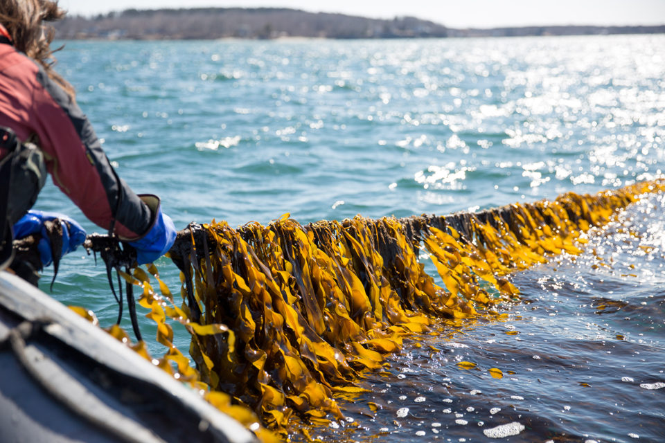
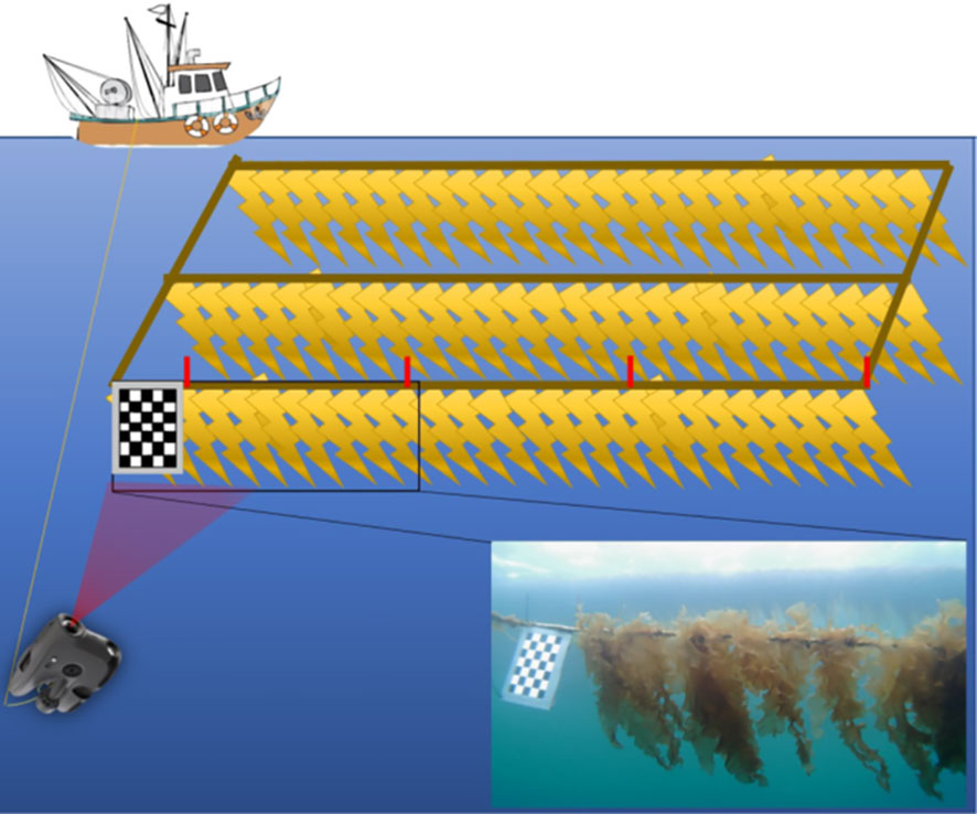
Farmed seaweed typically grows vertically on long horizontal lines, with a farm consisting of many such lines separated by ~10 meters and spanning several hundred meters each. In order to cultivate the oceans efficiently, robots such as autonomous surface vehicles (ASVs) can be used to monitor the growth and health of seaweed at scale.
A promising sensor for assessing seaweed quality is the underwater hyperspectral imaging (UHI) camera, which captures hundreds of spectral bands (compared to three in RGB). This makes it possible to detect subtle variations in seaweed health and distinguish seaweed from biofouling organisms. However, UHI cameras use a pushbroom configuration: they capture one spatial line at a time, requiring accurate knowledge of the camera’s position, attitude, and timing to reconstruct a 2D image — a process known as geo-referencing. Vessel motion, waves, and timing errors all degrade this reconstruction. An alternative is a multispectral camera (~10 spectral bands, 2D snapshots), which is simpler to geo-reference but provides less spectral information.
Scope
The central challenge of this project is that the quality of the imaging data is tightly coupled to how the ASV is controlled. Vessel speed, heading accuracy, wave-induced motion, and camera timing all interact to determine whether the resulting images are useful. This project treats the control system and data processing pipeline as a jointly designed system, rather than independent components, and uses simulation to characterize and optimize this interplay.
Concretely, the student will set up a simulation environment (e.g., ROS 2 with Gazebo or equivalent) consisting of:
- a dynamic model of a small ASV subject to wave and current disturbances,
- a simplified seaweed farm geometry,
- simulated sensor models: GNSS, IMU, and a camera (pushbroom hyperspectral, multispectral, or RGB),
- a geo-referencing and image quality assessment pipeline.
The student will then design and evaluate a control and data pipeline for conducting survey passes along seaweed farm lines, with the goal of maximizing image quality. Key tradeoffs to be investigated include:
- Between control and data quality:
- What is the optimal survey speed? Higher speed means more ground covered and more light per exposure time, but introduces motion blur in the images.
- How accurately must the ASV follow the seaweed line? How does cross-track error translate to gaps or overlaps in coverage?
- How does wave-induced roll, pitch, and heave affect geo-referencing accuracy, and at what sea state does data quality become unacceptable?
- In the Navigation system:
- Which error sources matter most: heading accuracy, absolute position accuracy, IMU drift, or camera-navigation time synchronization? A sensitivity analysis across these factors will guide sensor and algorithm selection.
- In the data pipeline:
- What must be computed in real-time onboard (e.g., geo-referencing, coverage monitoring, re-survey triggering), and what can be deferred to post-processing?
- Does the controller need closed-loop feedback from image quality, or is open-loop sufficient?
The choice of camera type (pushbroom hyperspectral vs. multispectral or RGB snapshot) affects all these.
| Farmed seaweed, source | Seaweed farm, Overrein et al. (2024) |
|---|---|
 |
 |
Proposed tasks
The exact scope will be shaped together with the student, but the following steps form a natural progression:
- Literature study: survey ASV-based marine monitoring, geo-referencing of pushbroom cameras, and hyperspectral/multispectral imaging in aquaculture.
- System modeling: establish a simulation of the ASV, sensor suite, and seaweed farm in ROS 2 / Gazebo (or equivalent).
- Baseline controller: implement a path-following controller for the ASV to make survey passes along the seaweed lines. Evaluate data quality under idealized conditions.
- Sensitivity analysis: systematically vary control performance, navigation accuracy, sea state, and survey speed. Quantify the impact on image quality. Identify the dominant error sources.
- Co-designed pipeline: based on the sensitivity analysis, propose improvements to either the controller (e.g., speed adaptation, wave feedforward) or the data pipeline (e.g., quality-aware geo-referencing, adaptive re-survey triggering). Evaluate the improvement.
- Discussion and report: critically assess the results, identify the most promising concept for continuation in the master thesis, and discuss what field validation would require.
The work will continue in a master thesis in the spring semester. Depending on results from the project, field trials with the ASV are a realistic option.
Prerequisites
The following competences indicate the direction of the project, not strict requirements. The student’s background and interest will determine the emphasis:
- guidance, navigation, and control of robots, particularly marine vessels
- robotic/computer vision and geo-referencing
- ROS or other robotic middleware
- simulation tools such as Gazebo, Unity, or equivalent
- signal processing or hyperspectral/multispectral imaging
Contact
Contact supervisor Kristoffer Gryte, or co-supervisor Morten Alver
References
Overrein, Martin Molberg, Phil Tinn, David Aldridge, Geir Johnsen, and Glaucia M Fragoso. 2024. “Biomass Estimations of Cultivated Kelp Using Underwater RGB Images from a mini-ROV and Computer Vision Approaches.” Frontiers in Marine Science 11: 1324075.